
About This Project
Easilink Community Transport provides accessible transport for people across the Omagh, Strabane, and Foyle areas. Through the STRIDE Programme, Easilink explored how digital innovation could address a significant evidence gap in understanding rural transport needs. The original concept focused on a community travel diary and journey-logging tool, but the final project evolved into a Geographic Information System (GIS) accessibility mapping and data analysis solution. By combining existing service data with census and demographic information, the project provides evidence-based insights into transport accessibility, service reach, and underserved communities.
Design Thinking Workshops
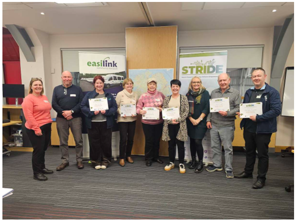
A 1-day STRIDE Design Thinking Workshop was held on 14 January 2026. The 14 participants included Easilink staff, service users, local councillors, Department for Infrastructure representatives, students, and members of the public.
Activities included Empathy Mapping, Point of View development, Challenge Definition, Ideation, Prioritisation, Prototyping, and Solution Testing. Crucially, the workshop identified transport data gaps, invisible unmet demand, first and last-mile connectivity challenges, and the inherent difficulty of measuring rural mobility patterns without a data-driven approach.
Deliverables
STRIDE deliverables included:
• Implementation of GIS-based accessibility mapping that combines service user data with NISRA Census 2021 datasets to identify communities experiencing potential transport disadvantage and limited accessibility coverage.
• Creation of an evidence-based analytical framework capable of identifying service gaps and areas of unmet demand using existing datasets rather than relying on resource-intensive primary data collection.
• A comprehensive prototype of how data collection, management reporting, and spatial demographic analysis tools can support future funding applications, strategic planning, and policy engagement.
Results & Impact
The primary technical outcome is an advanced mapping framework that visually demonstrates how community transport supports social inclusion, independence, healthcare access, and wellbeing. This community-centred digital innovation provides Easilink with stronger evidence of its impact for funders and policymakers.
Furthermore, it offers improved understanding of rural transport barriers, capturing hidden demand, missed journeys, and connectivity challenges that are often absent from conventional transport datasets. The project lays a robust foundation for the future development of travel insight surveys, transport personas, mobility monitoring, and highly targeted, data-driven transport planning tools across Northern Ireland.