
About This Project
Boho Community Association (Boho CA) is a registered charity established in 1992, serving the rural community of townlands centred on the Boho area. Operating from an extended community centre on the site of the former Tullyholvin National School, the association facilitates vital education, social, and recreational activities to relieve rural isolation and improve community health. However, the area faces a severe and persistent challenge: road flooding that frequently cuts off residential houses, blocks access to Killyhommon Primary School, and isolates the area from carers and emergency services. The community identified that mindlessly navigating these approach roads was detrimental to daily life and highly dangerous. The agreed solution focused on establishing a real-time, digital Flood Level Alert System to visually inform residents and agencies of exact flood depths at all approach roads, enabling better route planning, reducing vulnerability, and increasing community resilience.
Design Thinking Workshops
12 participants attended the Design Thinking Workshop on 23 February 2026 at The Workhouse in Enniskillen. Participants included the Chair and members of Boho CA, the Killyhommon Primary School Principal and Chair of the Board of Governors, a local domiciliary care worker, a childminder, local farmers, and the Fermanagh and Omagh District Council Emergency Planning Officer.
Participants were provided with an overview of the STRIDE Programme and an introduction to the Design Thinking process, then divided into three mixed sub-groups to ensure different community viewpoints could be expressed. The workshop helped define the overarching community priority: A real-time, localised, inclusive digital system that presents information visually and simply, reflects actual flood depth, works for both locals and visitors, integrates with relevant agencies, and reduces the need for individual manual coordinators.
Key components agreed upon included real-time depth readings with a visual Red/Amber/Green status, named flood points utilizing What3Words precision, push/SMS alerts, alternative route suggestions, and potential API integrations with emergency services, the DfI, Met Office, and local council bodies.
Deliverables
To meet the community’s needs without requiring expensive private gateways or residential broadband backhaul, the STRIDE team embarked on a hardware testing phase. Deliverables included:
Evaluation of Low-Power Wide-Area Network (LPWAN) protocols, specifically comparing NB-IoT, LoRaWAN, and Sigfox.
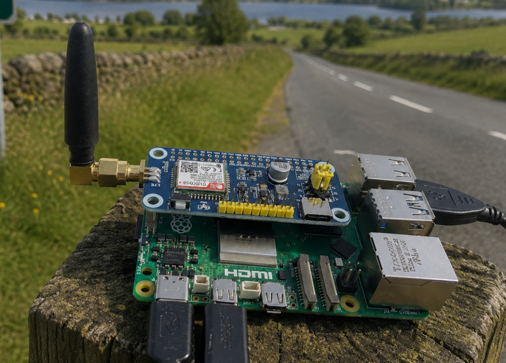
A custom battery-powered Raspberry Pi testing prototype running a Python telemetry script to map rural signal strength.
Hands-on field surveys driving across critical flood-prone corridors (Samsonagh Road, Lisdead / Crott Road, and Aghaherrish Road) to sample and decode cellular transceiver metrics.
Selection of the Dragino DDS75-NB ultrasonic non-contact sensor as the optimal, durable hardware for the sites.
Results & Impact
The active prototype phase successfully confirmed stable NB-IoT cellular coverage across all critical test locations in Boho. This proved that a direct-to-cellular solution is a highly viable, low-cost option for the terrain.
The primary impact of this intervention is a significant reduction in community vulnerability. By selecting the optimal hardware and proving the network concept, Boho CA is laying the technical foundation for a system that will allow domiciliary care workers, school staff, and emergency services to safely navigate or bypass flooded corridors. The solution also operates with high operational cost efficiency, requiring a low capital cost of just £135 for the sensor and £10 for SIM data, while the signal testing rig was built for under £60.